
LOCAL
HERITAGE
SOCIETY
Guided Tour
Welcome to a guided tour of Utö. You will see the main attractions of the island.
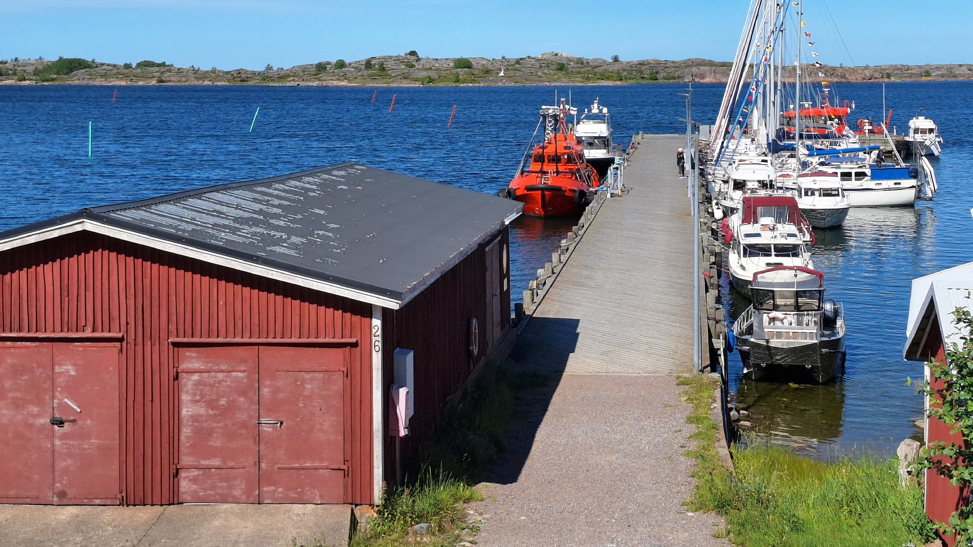
1. Main Pier
You can start your tour, for example, from the large bridge in the middle of the village. 'Stora bron' – on Utö, the piers are called bridges – was built by the Russians during World War I and certainly lives up to its name.
A hundred meters long, it extends out onto the 'flada,' Utö people's term for the remarkable natural harbour formed between Utö in the south and Ormskär with Kobban in the north.
Stora bron is currently used by the Pilot Service's pilot cutters but is no longer used by the connection boat. During the summer, the bridge is visited by thousands of leisure boats.
2. Crossroads
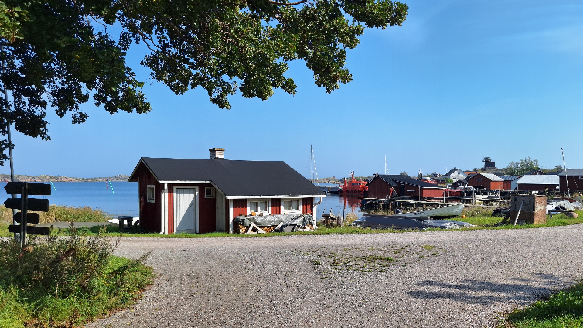
From Stora bron, take a right. Walk along Utö’s main street westward, past a number of picturesque boathouses.
You will reach a fork in the road where the right path leads to Utö Havshotel, which was previously a military garrison. Take a right if you want to see the hotel area. On the way to the hotel, you will also pass the Village Hall, Hembygdsgården.
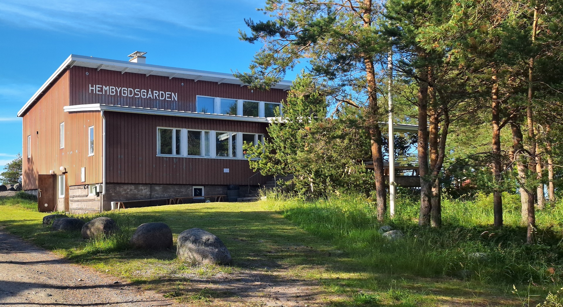
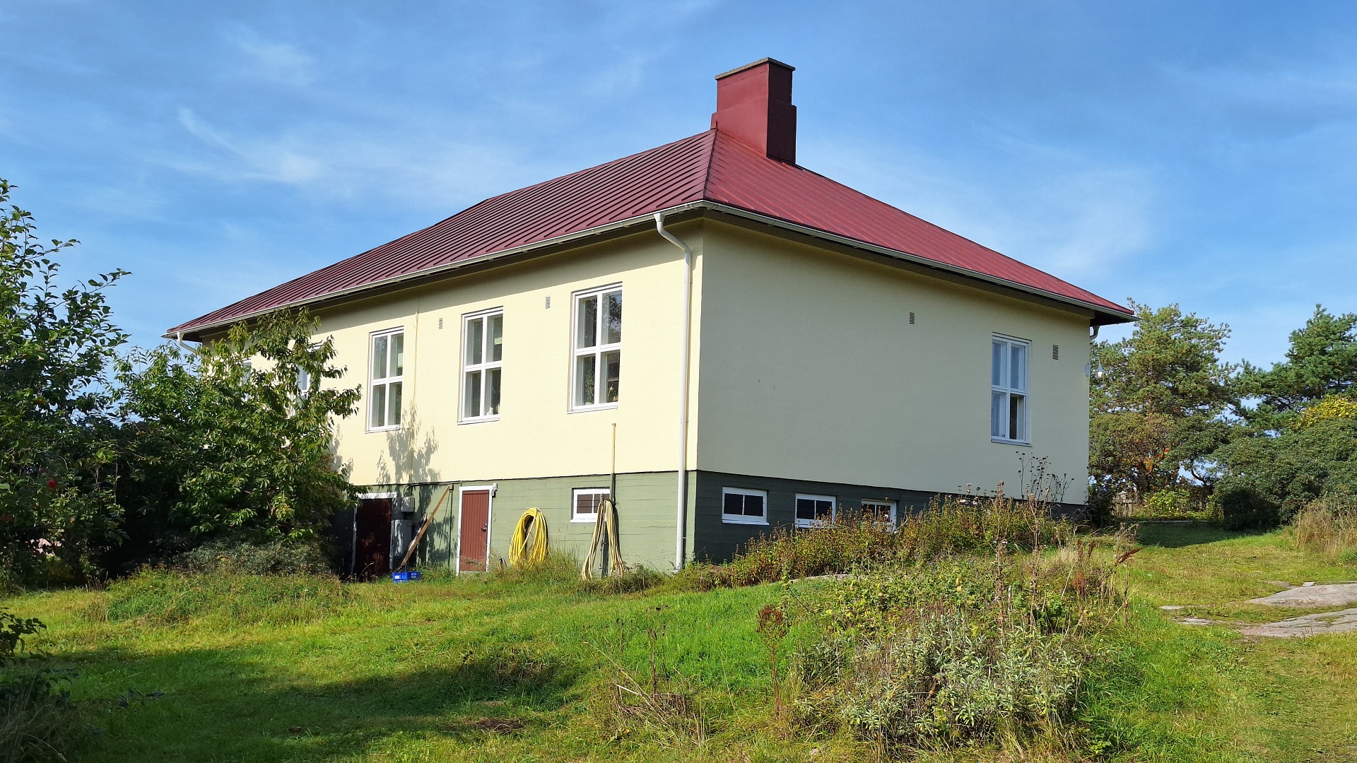
3. Village Hall
The Village Hall is located on Utö’s main street in Enskär. The building serves as a meeting place for the people of Utö, and various events are held there. The biggest annual celebrations are the traditional midsummer festivities and the summer dances in July. Utö’s library also operates year-round in the same building. Previously, the Post Office had its operations in the basement of the building.
The Village Hall was completed in 1965, but as early as 1955, the pilot Fridolf Öhman and his wife Anni had donated the land. The previous year, funds had begun to be raised for the construction, and the foundation was poured as volunteer work by the villagers that same year. The Maritime Administration helped with transportation. The financial conditions were not easy.
Even in the late 1960s, most of those working as pilots and lighthouse keepers on Utö were living on the island. At that time, the Local Heritage Society also operated during the winter. New Year’s parties were often celebrated at the Village Hall. New Year’s and summer parties were held with food and dancing. A popular program during this time was when the island's younger talents performed ballet.
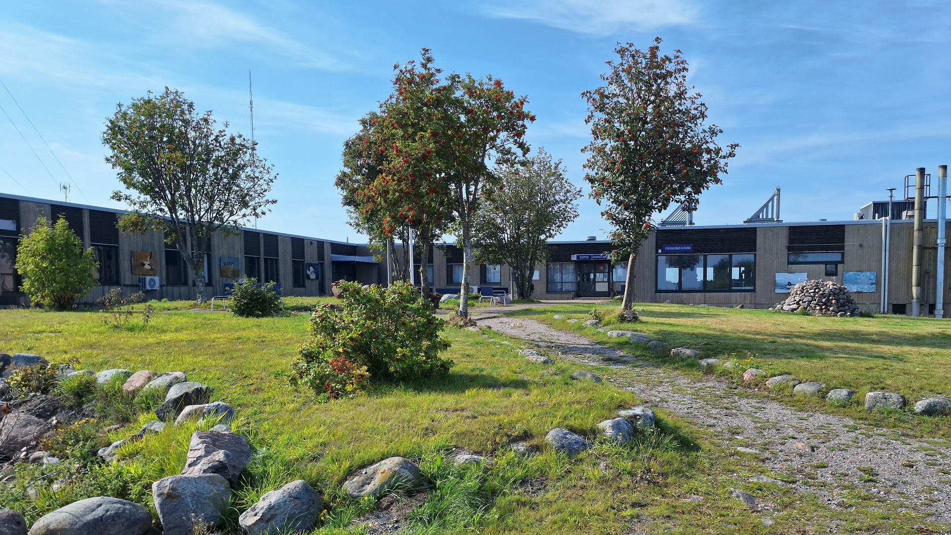
4. Enskär
A large part of Enskär was previously a military area and closed off to visitors. In 2007, Enskär’s former garrison area was purchased by a hotel entrepreneur, and the barracks now function as a high-quality hotel with a restaurant and guest harbor.
The soldiers arrived on Utö in 1912. At that time, a fort was built on the island as part of the Russian coastal defense. From 1918 to 2005, Utö Fort served as an important link in Finland’s coastal defense. Construction of the current barracks began in 1973 and was completed in 1978, when two row houses with twelve apartments for personnel were also finished.
On the former barracks site, there is also Utö’s water treatment plant, which produces drinking water from seawater for the entire village’s needs. Utö has its own water and sewage system.
If you continue your walk past the barracks all the way to the shore, you will reach the connection boat pier. The connection boat operates between Utö and Pärnäs in Nagu almost daily throughout the year.
Now, you can turn around and walk back toward the village to the intersection.
5. School
Turn right at the intersection and head west. Walk a bit along the road and look north, and you'll see a yellow stone building. The school of Utö started in 1884, as the first public school in the Korpo municipality.
The reason that public schooling was introduced early on Utö was that, at the end of the 1800s, the pilot services required literacy from aspiring pilots. To ensure that the profession would continue in the family, the people of Utö decided to start their own school together with the people from Jurmo.
Today, the school is Finnish-speaking, and the number of students in grades 1–6 has recently varied between 3 and 13. If the school symbolizes historical Utö, it could be said that the newly built house below the school building represents the present and future.
In the building, there is a station that strengthens the signal of a broadband fiber cable, which was laid from Sweden to Finland in the summer of 2000. Utö School is now directly connected to the cable, providing a fast and modern IT connection.
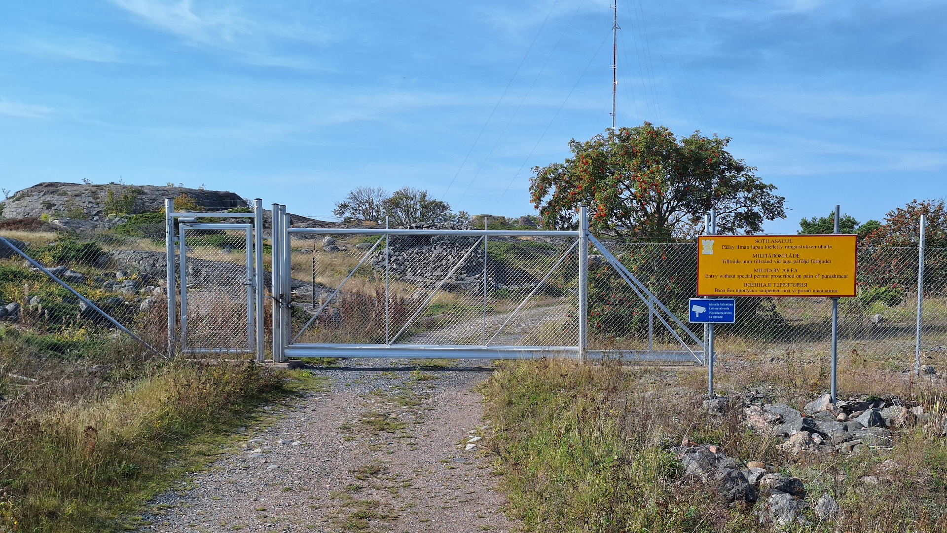
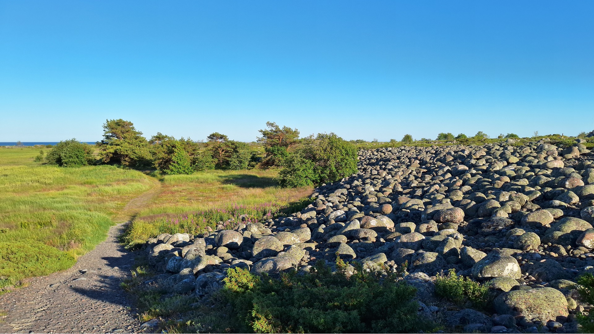
6. Western Headland
In front of you, you can see the military area of Västra Udden, which is fenced off.
On Västra Udden, you can still discern the traces of the Russian military’s presence on Utö. Behind the fence, there are casemates made of stone and concrete, which served as the base for a four-gun 152 mm battery.
During World War I, the Russians constructed a proper cobblestone street through the village, and on Västra Udden, the cobblestone street has been preserved almost intact. Along the road, a railway track was also laid for ammunition transports. The track was only removed in the 1960s.
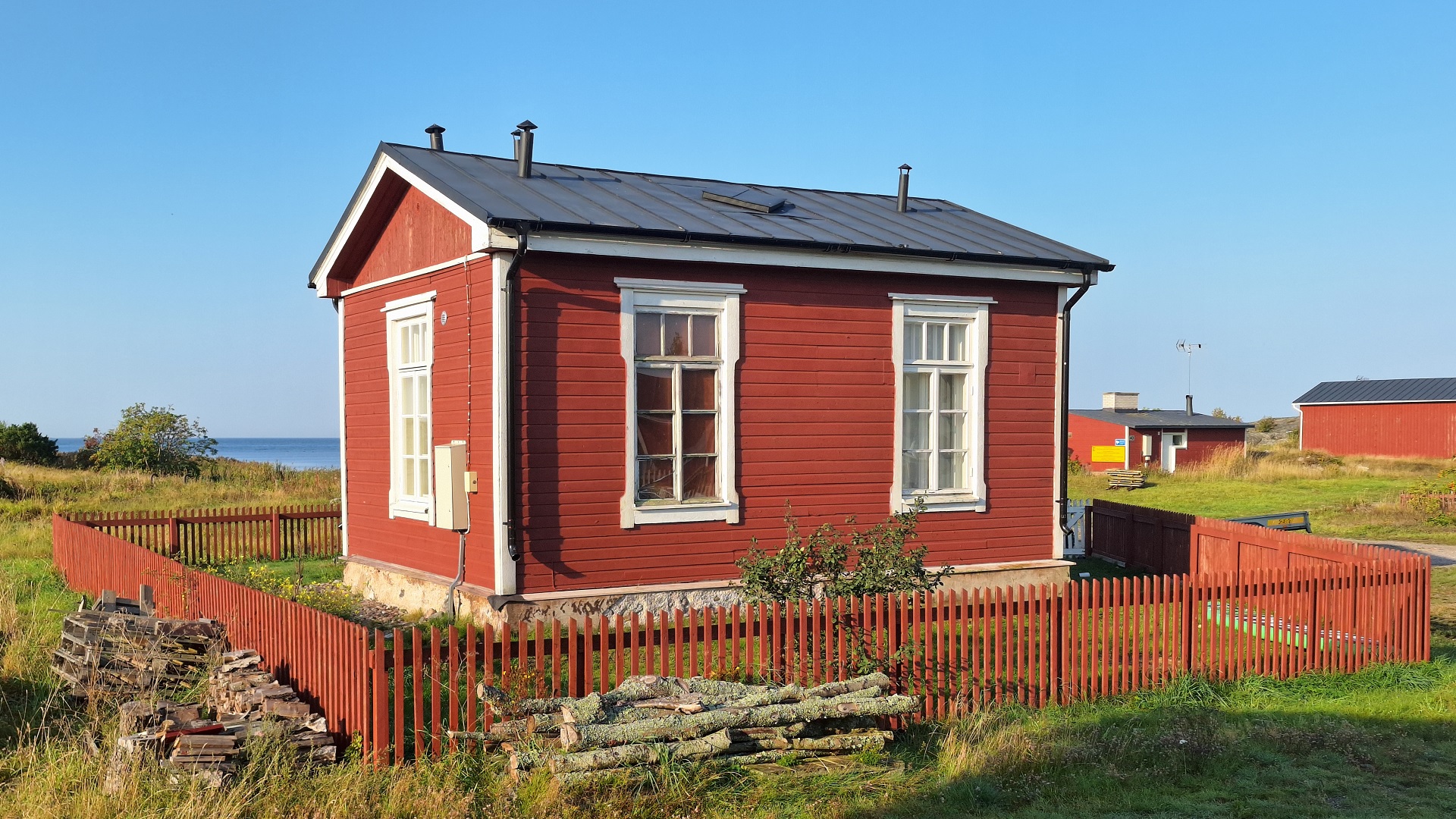
The large yellow building on the left, Adolf-Öhmans, like many other houses on Utö, served as a barracks during World War I.
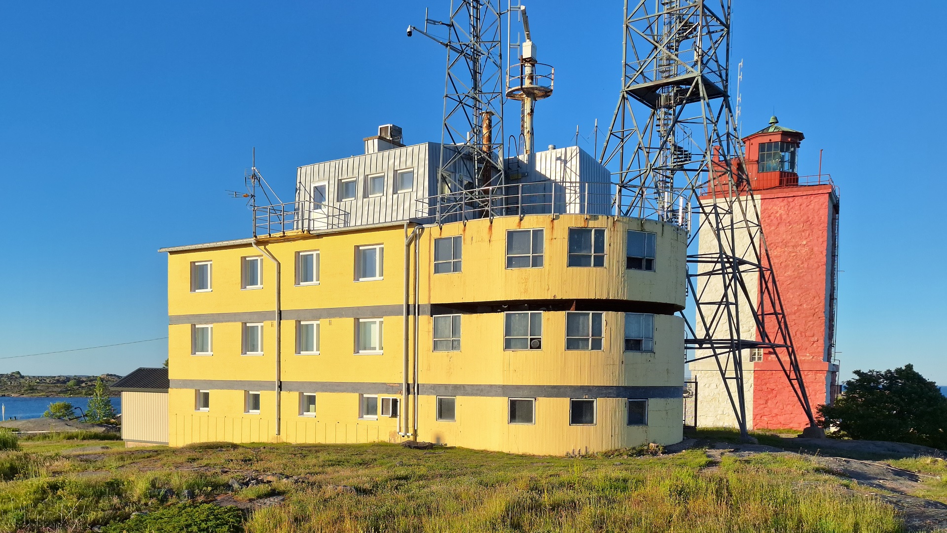
7. Pilot Station
After Adolf-Öhmans, we turn left and continue along a path and up a few stairs to the hill upon which the lighthouse stands. We first head to the southern side of the yellow-and-black pilot station building, where we get an excellent view of the sea.
South of Utö, there are only a few small islets and rocks, and about 120 kilometers to the south-southeast lies Hiiumaa in Estonia.
The current pilot station was built in 1958, replacing a wooden structure whose framework was likely erected as early as the 1840s. That pilot services were available at Utö as far back as the mid-17th century is evident from Johan Månszon’s logbook.
Permanent settlement came to Utö with the crown pilots in the 18th century. In Månszon’s time, the pilots still lived on Jurmo, but in the 1740s, two of the Jurmo farmers moved with their families to Utö and became permanent crown pilots. Utö was only separated from Jurmo village administratively at the end of the 19th century.
Since the mid-19th century, the Utö pilot station has served as the most important gateway to the Finnish archipelago. The number of pilotage operations peaked around 1970, at just over 2,300, but has since declined significantly.
Today, from Utö, vessels are piloted to all the major ports in the Finnish archipelago — from Hanko in the southeast to Enskär in the northwest, and also in the opposite direction out to sea.
The busy traffic has contributed to Utö’s unfortunate reputation as a ship graveyard. At the Utö local heritage museum, you can explore the dramatic shipwrecks in the waters around Utö through stories, objects, and photos.
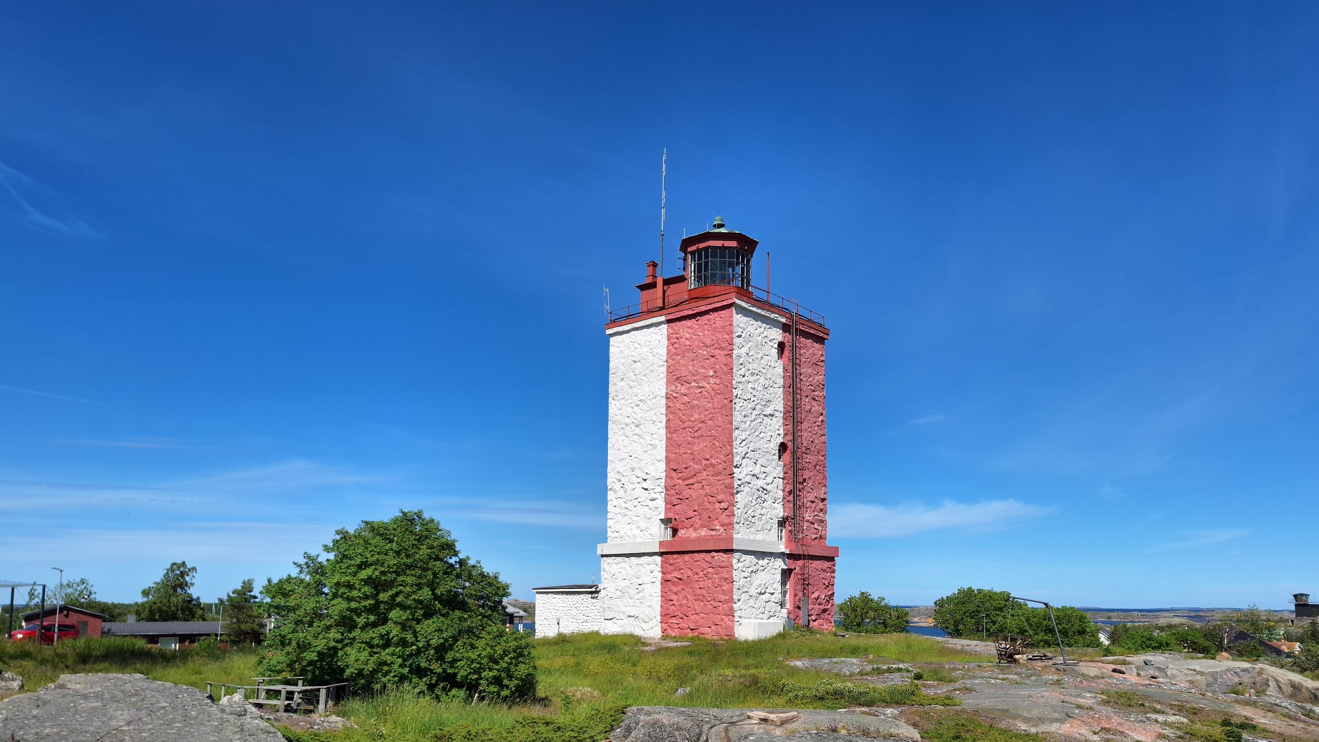
8. Lighthouse
Finland’s first lighthouse was built on Utö in 1753. However, this round lighthouse was demolished during the war of 1808-09. The current lighthouse was constructed in 1814 under the direction of the pilot director Gustaf Brodd. The lighting system and lantern part of the lighthouse have been renewed several times since. The current lens was installed in 1906.
On the third floor of the lighthouse is a curiosity: a chapel. The chapel was set up at least before 1841, when it was mentioned in the report of Commodore Alexander Wallrond. Official priest visits to Utö occurred only twice a year, but it was customary for the older men of Utö to take turns performing so-called postilla services in the lighthouse chapel every Sunday.
The lighthouse was operated by a couple of men during the Swedish period, but during the Russian period, the lighthouse staff was significantly increased. The lighthouse keeper was, during the Russian era, the highest-ranking official on the island, and the lighthouse keepers could sometimes be ordered to temporarily replace the pilot station chief when he was unable to carry out his duties for one reason or another.
Until the time of icebreakers, the lighthouse was extinguished during the time the sea was frozen over. The Utö lighthouse was electrified in 1935, and at the same time, a radio beacon was installed. During the Continuation War in 1943, the lighthouse's power plant began producing electricity for the entire village’s needs, and the people of Utö received electricity to their homes as early as the 1940s. In 1983, the military took over the power supply, and Utö received mainland electricity in 1996.
At the entrance to the lighthouse, there are two plaques commemorating wartime events. One is dedicated to the memory of the battleship Ilmarinen’s sinking on September 13, 1941. The other describes the Soviet Navy's attack on Utö fort at the beginning of the Winter War on December 14, 1939.
The chapel in the lighthouse can be visited during guided tours of the lighthouse. However, the room with the lens system is not open to the public.
Continue your walk eastward from the lighthouse, down the hill, and you will arrive at Stenhuset.
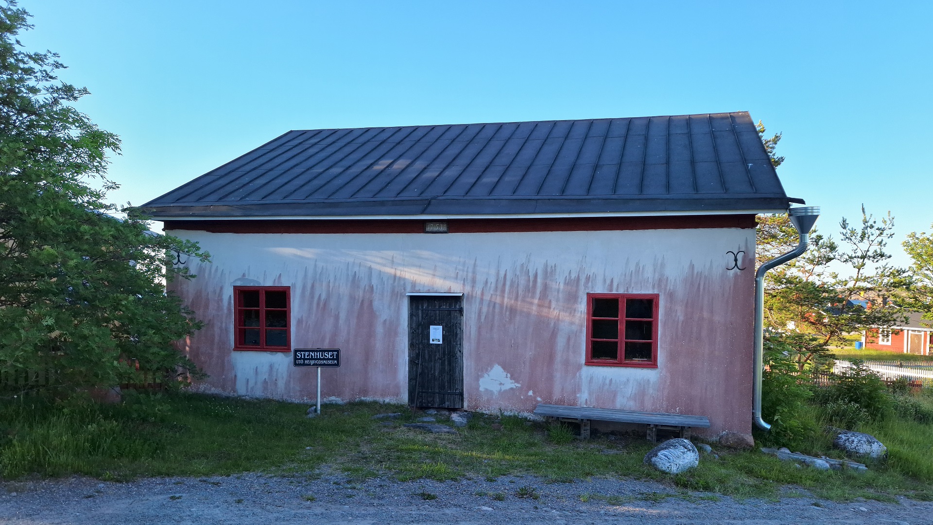
9. Museum
The museum building is called Stenhuset (The Stone House). It was built in 1753 in connection with the construction of the first lighthouse and is thus Utö’s oldest building.
Stenhuset served as a residence for the lighthouse keepers until the 1860s, when the fireplaces were torn down. By that time, the lighthouse keepers had mainly been living in the new building constructed on the other side of the road in the 1840s.
Stenhuset then served as a storage, workshop, and firewood shed until the 1990s, when the Maritime Administration had the building extensively renovated and then leased it to the Local Heritage Society, which opened a Local Heritage Museum there in 1991.
The exhibition at the museum focuses on Utö’s unique position as a service community in the outer archipelago and describes the history of the pilots, lighthouse keepers, and military personnel on Utö. Life on Utö was, of course, much more than just these civil servants, and the exhibition also provides an image of life in the local community, as well as fishing and hunting.
At the museum, you can also see photographs of Utö in different seasons, listen to stories from old times, and learn more about the many shipwrecks that have occurred in the waters around Utö.
10. Homesteads
From Stenhuset, we continue eastward down the hill, take a turn to the left, and arrive at an intersection on Utö’s main street. We stop here for a moment and look back to the south. We are now standing at the site where the first settlement on Utö was established.
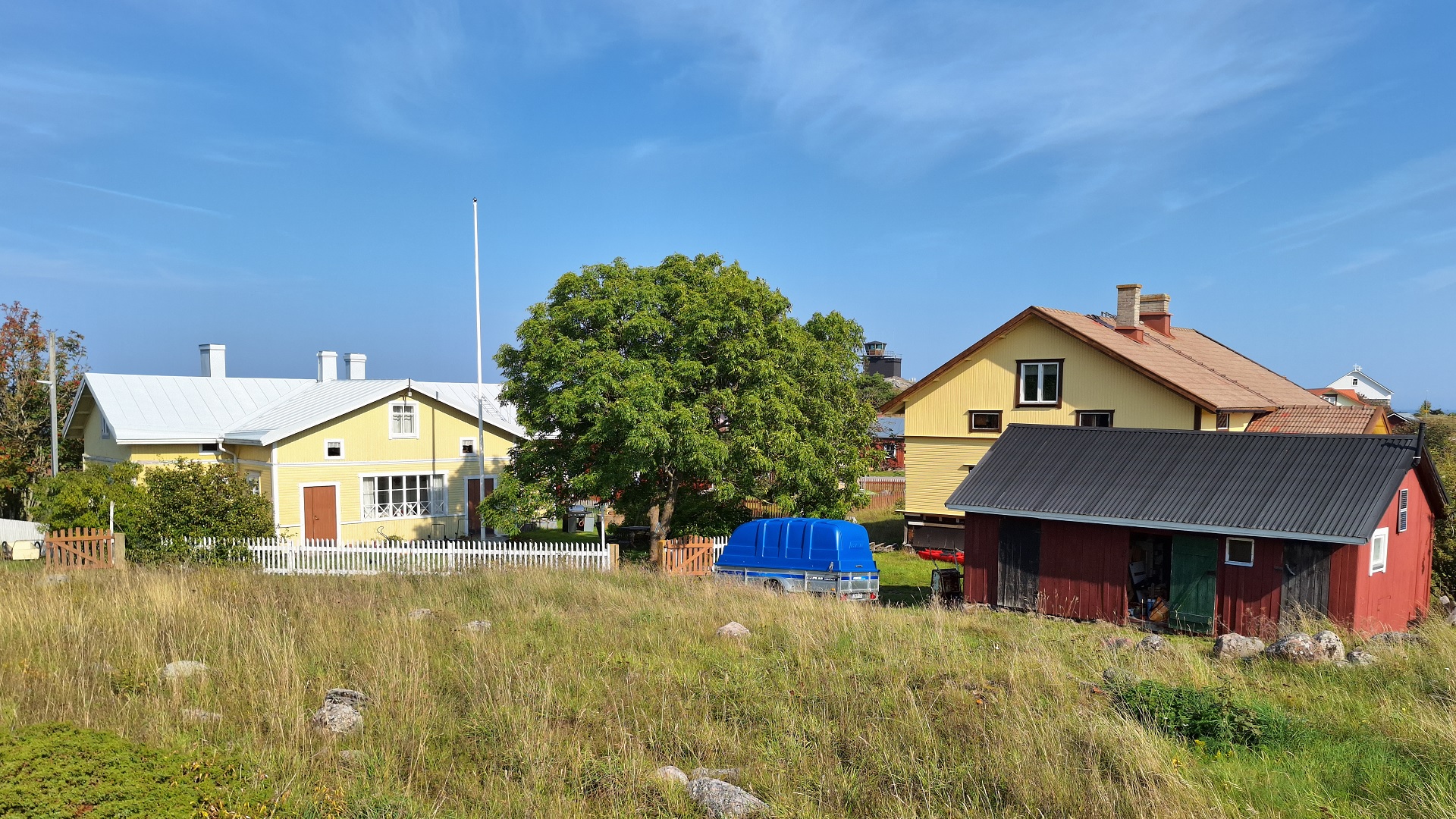
The original two, later four after a division in the 1770s, pilot homesteads on Utö – Västergrannas (Vestras), Norrgrannas (Sandas), Östergrannas (Grannas), and Södergrannas (Mattas) – were built in a tight cluster on the area to the northeast and east of the local heritage museum.
The location is well-chosen. It is well protected from the prevailing southwest winds. Of the older, though not original, homestead buildings, Grannas and Mattas still remain (two large yellow-painted houses). Sandas’s lot is undeveloped, and to the right of Vestras’s yard, there is a new building. Around the homesteads, the rest of the village gradually grew.
During World War I, the Russians tore down some of the older houses and rebuilt them in their own style. The village’s appearance has later been shaped by the military's new constructions. The result of this development is a remarkably large and tightly grouped village, which, thanks to the wide roads, gives an almost 'urban' impression.
Today, about 40 people live on Utö year-round.
11. Eastern Village
Continue your walk to the right along the cobbled street and take another right. You’ll walk between two red mill houses, cross the field, and arrive at the eastern part of the village.
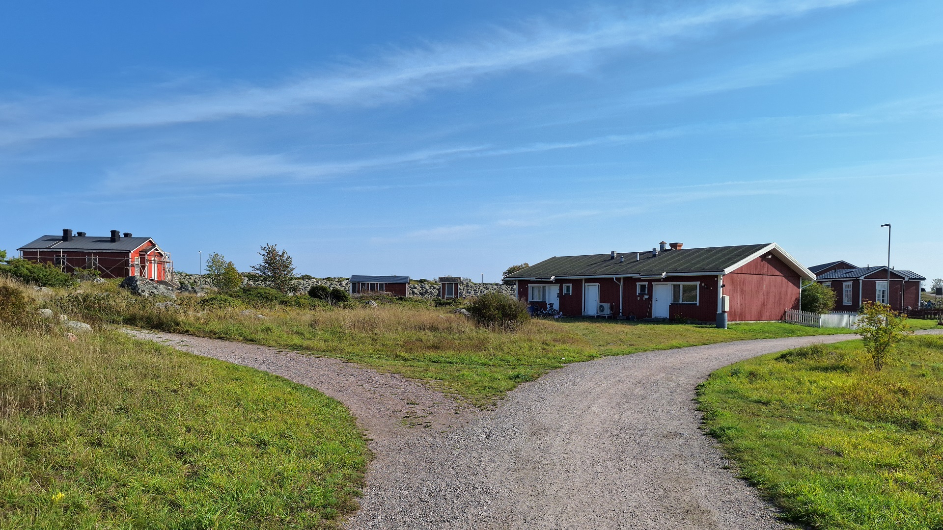
A new era for Utö began at the end of 2005 when the military withdrew from Utö. Since the defence forces, which were the island’s largest employer at the time, left Utö, it has been the Utö Local Heritage Society that works to ensure the island remains inhabited year-round.
A real estate corporation founded by the Utö Local Heritage Society purchased the military’s old housing in the eastern part of the village in 2006 and today uses them as rental homes for year-round residents. The majority of Utö’s rental homes are located here, on the left side of the road, just below the church.
Continue along the road towards the southern point, and on the left side, you’ll see a memorial stone for a Russian telegraphist who fell in battle. Utö was subjected to a naval attack during World War I, when the German Imperial Navy on August 10, 1915, tested the strength of the Utö fortifications. At that time, the Utö batteries responded so effectively that after an inconclusive exchange of fire, the Germans withdrew.
12. Russian Architecture
If you look around this part of the village, you will see a couple of examples of Russian Tsarist military architecture on Utö. For example, the small red house closest to the memorial stone, Telegrafen (The Telegraph), has clear Russian characteristics such as tall windows and decorative trim boards. The house was previously used as a telegraph station.
Kojuvret, a large red house with four thick chimneys located a bit further up to the east, also represents Russian architectural style. The house was built by the Russian army during World War I, and according to Russian tradition, each fireplace has its own chimney.
The roof with its four chimneys reminded the people of Utö of a 'koju' (a type of Russian wooden house), which is why the house was given its name. The height of the roofs of the Russian houses is also different from what was customary in Finland.
13. Kesnäs
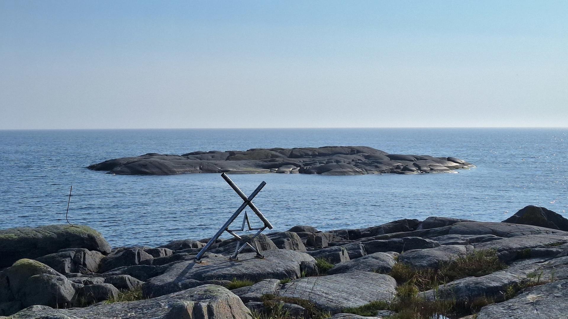
Our walk continues up a small hill towards Utö’s southern cape, Kesnäs. Turn right at the intersection. Kesnäs can be difficult to reach at the beginning of the summer due to aggressive nesting terns. But if they allow you to walk peacefully along the path through the heath, you will reach the southernmost point of Utö and the memorial, Stjärnan och Korset (The Star and the Cross).
The Star and the Cross were erected in 1989 in memory of the barque Draken, which sank here in 1929. The memorial stands today on the rock where the people of Utö, for two days, helplessly watched as the crew of the Draken struggled.
The shipwreck occurred on November 11, 1929, when the three-masted barque Draken from the town of Naantali ran aground on Örebåda, the high skerry that lies in front of you, about 150 meters from Utö’s southernmost point.
The storm raged with hurricane force for one and a half days, and despite the short distance, there was no possibility to rescue the shipwrecked. When the storm finally subsided somewhat, the people of Utö, with great effort, managed to rescue the survivors. Five men had already drowned or frozen to death.
The Draken tragedy was a push for organized sea rescue in Finland, and in 1934, Utö also received its own sea rescue station.
14. Waste Disposal
If you managed to reach the southern tip, now turn back and head towards the intersection. The road to the right leads to Utö's waste management station, which is a restricted area.
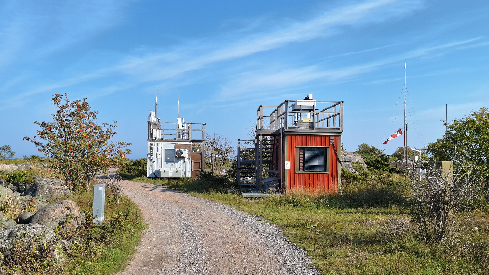
However, you can walk a little way towards it, pass Utö's meteorological station where Finland's Meteorological Institute's weather observation equipment is located.
To the right of the road, you can see old casemates made of stone and concrete that the Russians built during World War I as a foundation for artillery batteries.
The entire Kesnäs area was a military zone until 2004 and was closed to the public.
If you don’t want to get a closer look at the waste management station, turn around and walk back to Telegrafen. Turn right and walk up towards the church.
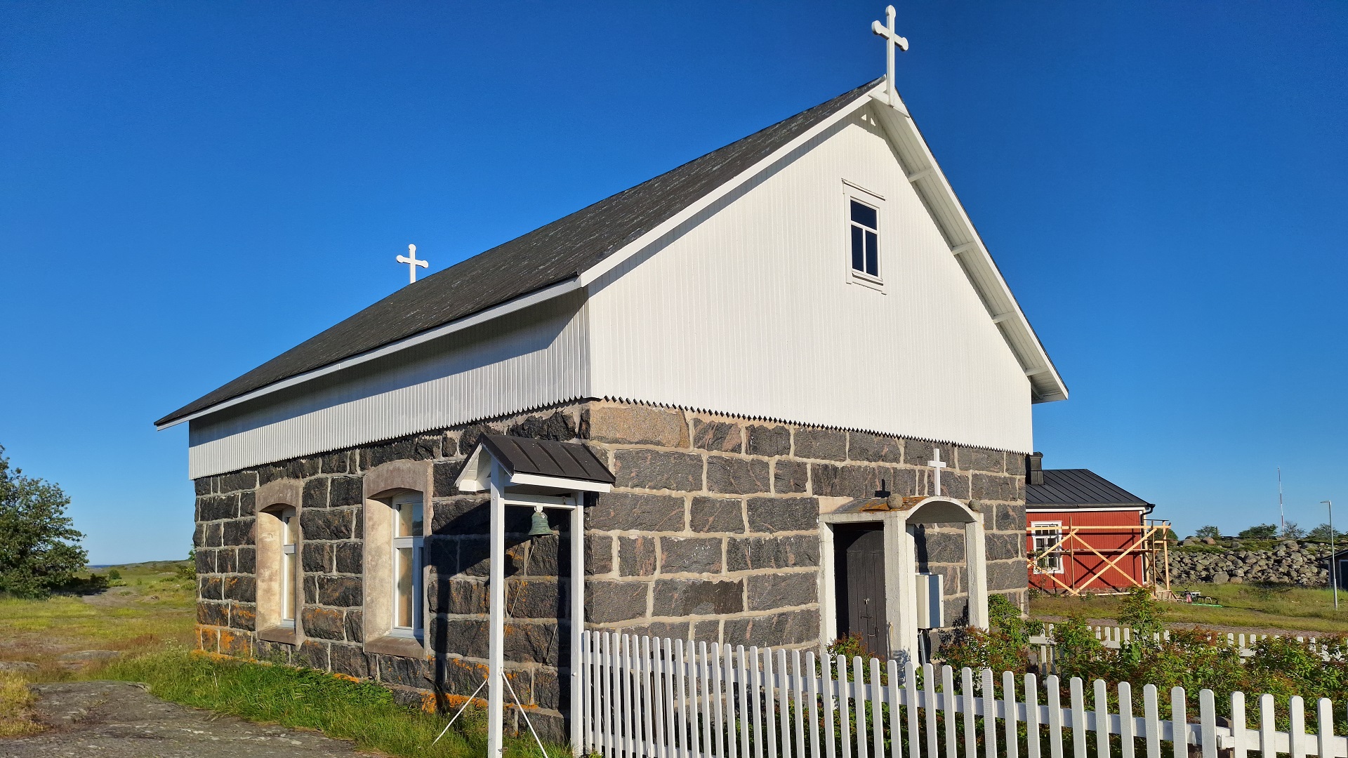
15. Church
The stone-built Utö's second church, was constructed through volunteer work and completed in 1909. According to tradition, the church was built because the elderly in the village found it difficult to climb up to the lighthouse church. The church is located at Fårberget, where the village’s mills once stood. Now, a military surveillance tower stands there.
In the church, it’s fitting to take a quiet moment, sit on the benches, and gaze out through the eastern window, the church’s 'natural' altarpiece. From the window, a beautiful view of the sea opens up, which on stormy days roars white over the many shallows east of Utö.
These shallows became the fate of the American freighter Park Victory on Christmas night 1947. The ship had anchored at Lillharu, southeast of Utö, on Christmas Eve in good weather. During the night, a powerful storm with heavy snow blew in, and Park Victory’s anchors gave way. The ship drifted and soon crossed several shallows, suffering multiple large holes in its hull. The vessel began to sink rapidly, and the crew took to the lifeboats.
After it was realized on Utö that Park Victory was in distress, the islanders set out with the pilot vessel, the rescue boat Merikokko, and the fort’s boat to assist those in need. After great efforts, the people of Utö managed to save 38 of the ship’s crew members. The rescued were cared for in Utö homes over the Christmas holidays. Despite this, the grim toll of that Christmas night was 10 lost sailors.
In the church, a ten-armed candelabra with the names of the deceased sailors engraved on it bears witness to the accident. On the wall hangs a letter of gratitude from the U.S. ambassador to the people of Utö.
From the Prayer House, we continue eastward down a slope and arrive at Utö’s largest meadow - Österäng.
16. Eastern Meadow
Österäng, not too long ago, was a bay, and even today, the northern parts of the meadow are often submerged.
Österäng was still used for haymaking and grazing until the mid-1960s. Since then, the meadow, like most cultural environments in our outer archipelago, has been significantly altered. Juniper bushes have reclaimed the terrain that the islanders once worked hard to cultivate. The grass is now clumpy and coarse.
In old photos, the meadow looks completely different—well-maintained with cows grazing. At its peak, there were over 20 cows on the island. Three of Utö’s homesteads even had haylofts on the meadow. In some places, you can still distinguish low ditches that are slowly growing over.
The hay harvest from older times, when Utö did not yet have permanent settlement and when the people of Jurmo mainly used Utö for haying, is still reflected in certain place names. On Grumålsberget, near the road leading down to the meadow, the people of Jurmo had their breakfast, and at Aftonmålsudden, they prepared an evening meal after the day’s work before heading home.
To the right, you can observe a particularly interesting terminal moraine in the shape of a crescent. This is the outermost extension of Salpausselkä III, which presents itself more prominently on Jurmo.
In the spring and autumn, the meadow is one of the most popular destinations for ornithologists. Utö is a paradise for bird enthusiasts during migration seasons, and a loyal group of birdwatchers returns to Utö every year. Occasionally, rarer sightings occur, attracting 'listers' from all over the country.
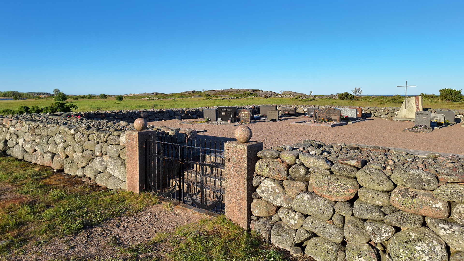
17. Graveyard
At the far end of the meadow is Utö’s cemetery. Considering the island’s long history and relatively large population, visitors might be surprised by the small number of graves. The explanation lies in the fact that Utö’s cemetery was only established in 1962. All sand for the cemetery had to be brought to Utö by barge. Previously, the people of Utö were generally buried on Jurmo.
Oral tradition has preserved many stories about the often perilous transports of the deceased to Jurmo in storms and over treacherous ice. If a death occurred in winter, the deceased would be taken to Jurmo and buried, while the actual funeral service was conducted later, during the summer, when the priest from Korpo visited.
The highlight of the cemetery is the monument to the victims of the sea, designed by Gösta Bergman. The monument is shaped like a square sail with a red patch, resembling the sails that were once used on pilot boats for service duties.
North of the cemetery stands a lone iron cross surrounded by heavy iron chains. This is the resting place of seaman Buchwald from the Imperial German Navy. Buchwald’s body was found washed ashore on Västra Udden on December 16, 1916.
Now, we return to the village, heading towards Stora Bron.
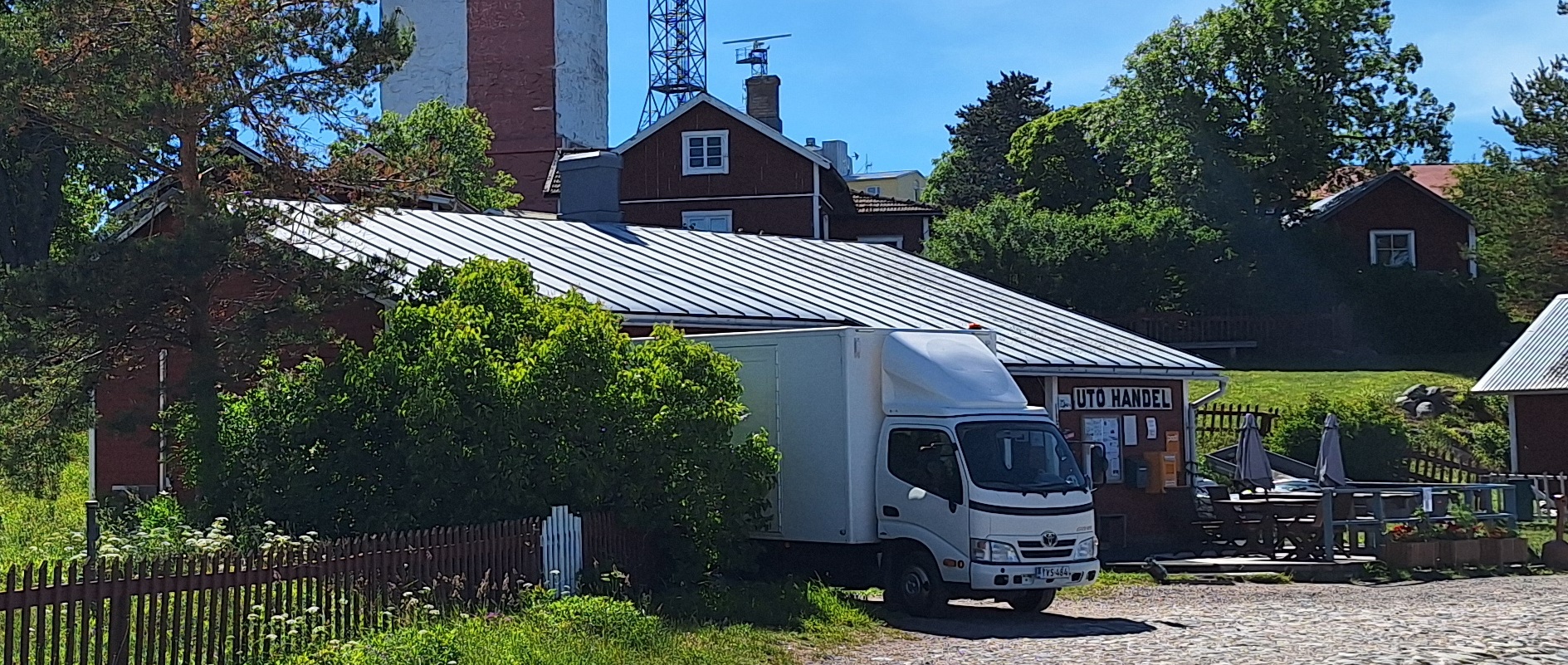
18. Grocery Store
Utö Handel was founded in 1932 by 14 families on Utö as a family business. The store still serves customers year-round. Since 1990, Utö Handel has been a limited company, but the shares are held by descendants of the families who founded the store.
In 1939, Utö Handel moved into the former main building of the Sandas estate, which had been transferred to the state after World War I. The house was located next to the Armory. The current store building was constructed in 1959, and over the years, many renovations and extensions have been made.
UTÖ LOCAL HERITAGE SOCIETY

The facebook group "Utö anslagstavla" contains Utö related posts. The group is not maintained by the Local Heritage Society.